Exploring the Dinara Foothills: Riding the M-14.2 Road in Croatia
Locals know best!
If you travel this road often or live close by you will be given a chance to provide your valuable rating soon! Sign in and stay connected.Location and Setting of the M-14.2 Road
The M-14.2 road is situated in southern Croatia, close to the border with Bosnia and Herzegovina. The route runs through the foothills of the Dinara mountain, Croatia’s highest peak, and is positioned near the town of Bosansko Grahovo. This area is characterized by its remote, mountainous terrain and sparse population, making it an appealing destination for riders seeking solitude and natural beauty. The road’s proximity to the Dinara mountain and the border region provides a sense of adventure and remoteness. An interactive map showing the precise route of the M-14.2 road can be found at the end of this article.
Road Characteristics and Riding Experience
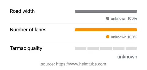
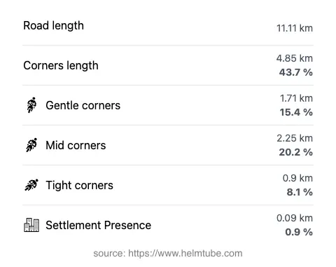
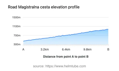
The M-14.2 road extends for approximately 11.1 km (6.9 miles), with elevations ranging from 442 m (1,450 ft) to 973 m (3,192 ft). The road is paved with asphalt, and while the exact surface quality is not officially rated, riders should expect conditions typical of rural Croatian mountain roads, which can vary from fair to good. The route is moderately twisty, offering a mix of gentle and sharper curves that require attentive riding but are manageable for most skill levels. The road is predominantly outside inhabited areas, with less than 1% passing through settlements, contributing to a quiet and uninterrupted ride. The maximum speed limit is 70 km/h (43 mph), which is appropriate given the road’s layout and elevation changes.
Access, Closures, and Seasonal Considerations
There are currently no permanent restrictions on motorcycle access along the M-14.2 road. However, as with many mountain routes in Croatia, temporary closures can occur due to adverse weather, particularly during the winter months when snow and ice may make the road impassable. Riders are advised to check local traffic updates and weather forecasts before planning a trip, especially outside the summer season. There are no known event-related closures affecting this route, but it is always prudent to verify current conditions with local authorities or online resources before departure.
Tolls, Fees, and Practical Information
The M-14.2 road does not currently require the payment of a toll or entrance fee for motorcycles or other vehicles. Riders should be aware that toll conditions may change in the future, and it is recommended to consult official sources for the most up-to-date information. For comprehensive details on road tolls and fees in Croatia, visit the Hrvatske autoceste website. Fuel stations and amenities are limited along this stretch, so it is advisable to refuel and stock up on supplies in larger towns before setting out.
Nearby Attractions and Points of Interest
While the M-14.2 road itself is primarily a transit route through a remote area, its proximity to the Dinara mountain makes it an attractive option for riders interested in exploring Croatia’s highest peak and the surrounding wilderness. The nearby town of Bosansko Grahovo, though small, offers a glimpse into the region’s history and culture. For those willing to venture further, the area is also not far from the Una National Park across the border in Bosnia and Herzegovina, known for its waterfalls and pristine rivers. These attractions provide additional opportunities for exploration and make the M-14.2 road a worthwhile addition to any motorcycling itinerary in the Balkans.
Explore the Region: Roads Close By
Discover more amazing roads located near the route featured in this article. The list below highlights nearby routes that are perfect for extending your ride or planning your next adventure.
Ride the Best: Croatia’s Top Motorcycle Roads
These are the best motorbiking roads in Croatia. The list below shows links to articles about top-rated motorcycle routes in the country. Explore the most popular roads in Croatia and plan your next unforgettable motorbike adventure.